
You've got one free morning in Las Vegas, a family with mixed fitness levels, or a summer itinerary that looks far less appealing once you step outside. You want dramatic red rock, not a generic walk beside a hotel, but the right choice depends on more than scenery. Effort, shade, drive time, parking, water, and reservation requirements can determine whether a hike becomes the highlight of your trip or an uncomfortable detour.
The best hiking trails Las Vegas visitors can choose from range from short interpretive walks to demanding canyon and arch routes. Red Rock Canyon delivers the region's signature sandstone, Valley of Fire offers high-impact color, and Mount Charleston provides a cooler alpine alternative when the valley heat changes the plan. Start early, wear proper footwear, carry enough water, and check conditions before leaving. A private itinerary can also simplify logistics for couples, families, corporate groups, and travelers continuing between Las Vegas and Southern California.
Table of Contents
- 1. Red Rock Canyon National Conservation Area
- 2. Moenkopi Loop Trail at Red Rock Canyon
- 3. Fire Canyon Trail at Valley of Fire
- 4. Icebox Canyon Trail at Spring Mountain
- 5. Calico Tanks Trail
- 6. Muddy Peak Trail
- 7. Prospect Trail at Red Rock Canyon
- 8. Red Rock Canyon National Conservation Area
- 9. Bridge Mountain Trail
- 10. Valley of Fire State Park
- 11. Mount Charleston Spring Mountain National Recreation Area
- 11 Las Vegas Hiking Trails Comparison
- Build the Right Las Vegas Hiking Day
1. Red Rock Canyon National Conservation Area
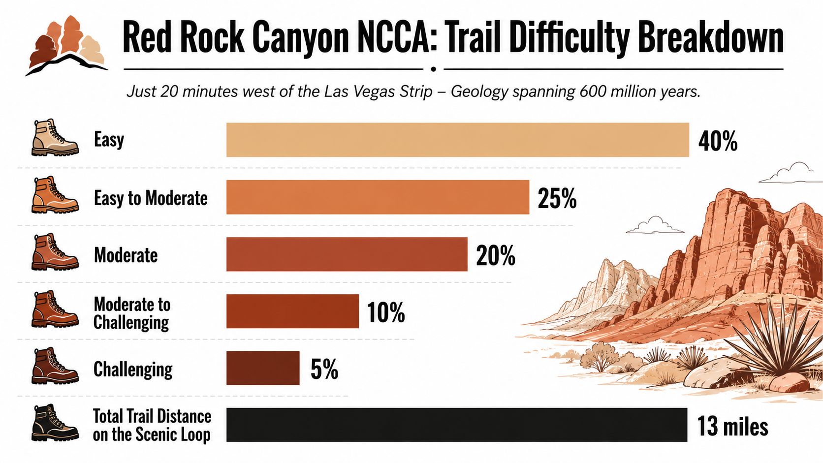
Red Rock Canyon is the essential first choice for visitors who want the classic Las Vegas desert scenery without committing to a remote expedition. The conservation area sits about 17 miles west of the Las Vegas Strip, covers 195,819 acres, and offers more than 30 miles of hiking trails, according to Travel Nevada's Red Rock Canyon guide and AllTrails' area overview. Its sandstone cliffs, open desert, and canyon walls create a stronger sense of wilderness than the short drive suggests.
For first-time visitors, the smartest approach is to pair one hike with the Scenic Drive rather than trying to collect several trailheads. The Scenic Drive requires timed entry from October 1 through May 31, while reservations aren't required from June 1 through September 30, as explained by Recreation.gov's Red Rock reservation page. Entry is $15 per vehicle, and the area has no potable water along the Scenic Drive, so self-sufficiency matters. For guided groups, the BLM also lists tight limits on some use areas, including a maximum of 8 hikers per day, with 4 groups or permits per day and 4 people per group, while parking is limited, according to BLM and National Park Service guidance.
Practical rule: In exposed desert terrain, an early start, dependable footwear, and more water than you expect to drink matter more than ambitious mileage.
Sunrise offers the most flattering light and the best chance of a comfortable walk. A private guide can add geological and cultural context while handling trailhead decisions, a useful upgrade for families and couples who want interpretation rather than just following a map. Travelers comparing Nevada and Southern California outdoor experiences may also enjoy this Red Rock e-bike tour resource when a lower-impact day is preferable.
2. Moenkopi Loop Trail at Red Rock Canyon
Moenkopi Loop is the polished, low-commitment introduction to Red Rock Canyon. The easy 1-mile scenic loop suits families, older travelers, and anyone fitting a natural-area experience between a late breakfast and an evening reservation. Colorful geology, desert plants, and interpretive signs give the walk more substance than its distance suggests.
This is a particularly good option when the group wants to say it has hiked near Las Vegas without turning the morning into an endurance test. The trail's educational character makes it useful for children, while the compact route gives adults room to pause for photographs and ask questions. Bring water and sunscreen even for a short walk. Desert exposure doesn't become harmless just because the trail is easy.
The best use of a short window
Arrive early in the morning or visit later in the afternoon, when the light brings out the warmer tones in the rock. Binoculars can add interest for wildlife watching, including the possibility of desert bighorn sheep and roadrunners, though sightings are never guaranteed. Reading the interpretive signs is worthwhile because they help explain how the area formed and why desert plants are adapted to such demanding conditions.
Moenkopi works best as part of a broader Red Rock plan. Combine it with the Scenic Drive, then choose a few viewpoints rather than rushing through every stop. That creates a complete half-day experience with manageable walking and strong visual variety. It's also a sensible recommendation for a first-time visitor whose priority is comfort, access, and photography rather than technical terrain.
3. Fire Canyon Trail at Valley of Fire
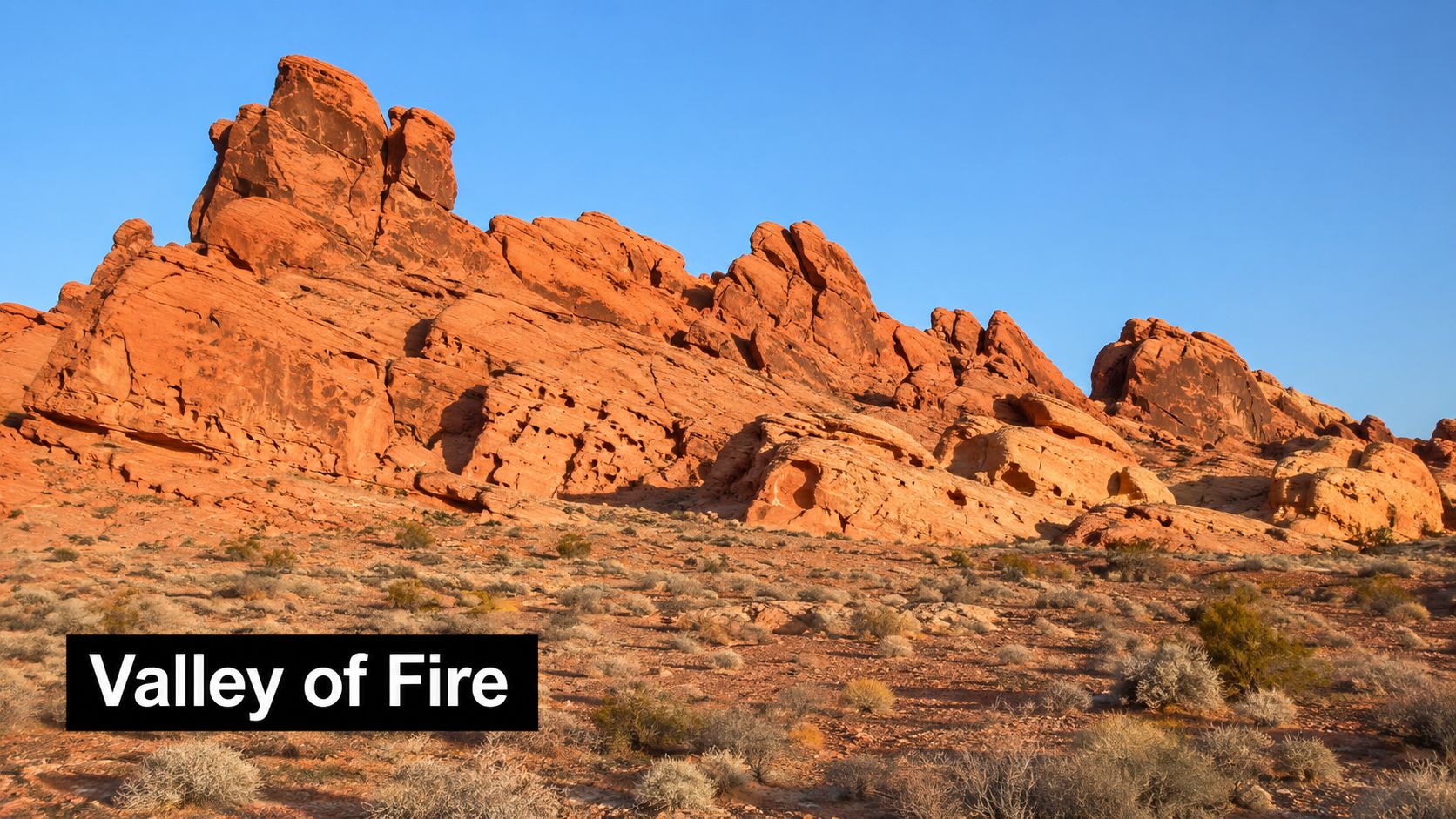
Fire Canyon is for the traveler who wants a memorable view quickly. This short 1.5-mile out-and-back route offers vivid red and orange formations with relatively little time on the trail, making it an attractive choice for visitors with limited hiking experience or a tightly planned Las Vegas stay.
Valley of Fire sits about 45 minutes northeast of Las Vegas, and the park is known for red sandstone, petroglyphs, slot canyons, and formations that have appeared in films. The journey is part of the appeal, but the trail itself supplies the visual payoff. Early morning and late afternoon bring stronger color and softer shadows, while midday can flatten the scenery and make the exposed route feel unnecessarily demanding.
A short hike with serious heat exposure
Arrive early, carry water, use high-SPF sunscreen, and wear a hat. The exact amount of water a person needs depends on temperature, pace, and body size, so don't treat a short mileage figure as permission to pack casually. If anyone in the group begins to fade, turn around before the discomfort becomes a safety issue.
A professional guide can make this outing more than a photo stop by explaining the geology and the cultural history of the area. That's especially useful for families and corporate groups, where different people may want different levels of activity. A private guide can also adapt the pace and build in stops without forcing the group into a rigid public-tour schedule.
4. Icebox Canyon Trail at Spring Mountain
Icebox Canyon offers a welcome change of character. Rather than walking through open, sun-baked terrain, hikers descend through a forested canyon on Mount Charleston, where shade and mountain air can make a summer outing feel substantially more comfortable than a low-elevation desert route.
The listed plan is a 2.5-mile round-trip hike, but the terrain can be uneven and the experience rewards a steady pace rather than a rushed one. Occasional waterfalls and a water source add atmosphere, although flowing or seasonal water shouldn't be treated as a reliable drinking supply. Bring your own water, and use an appropriate purification method if you're considering any backcountry source.
Cool does not mean effortless
The Spring Mountains offer more than 60 miles of maintained trails, with most trailheads beginning above 6,000 feet, while Charleston Peak reaches 11,916 feet, according to Mount Charleston trail guidance. Higher elevation can make visitors tire faster than expected, even when the temperature feels pleasant. Layers are important because mountain weather can change quickly.
Before driving up, check current access conditions. Mount Charleston's closure information lists closures affecting Mary Jane Falls, Trail Canyon, Upper Bristlecone, and Echo Trailhead under a Forest Closure Order in effect through May 12, 2027, unless it's rescinded. A guided outing can improve the experience by adding alpine ecology and by preventing a long drive to a trailhead that isn't currently available.
5. Calico Tanks Trail
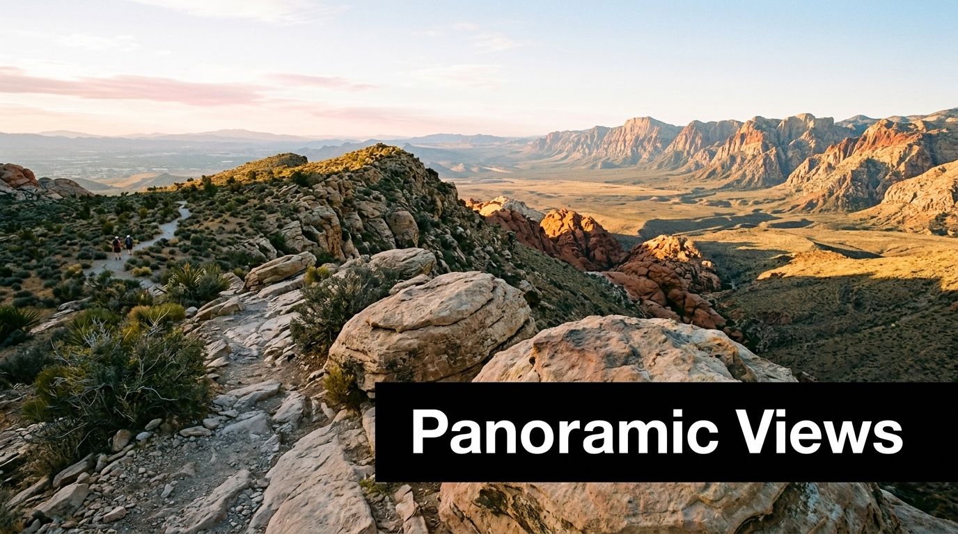
Calico Tanks is a strong middle ground for visitors who want a real hike, not just a viewpoint, but don't want to spend the entire day on the trail. The route is a moderate 2.5-mile round trip in Red Rock Canyon, leading through rocky terrain to natural tanks and broad valley views.
The scenery changes as the trail climbs. Instead of a single dramatic reveal, you get close contact with sandstone, uneven surfaces, and a gradual sense of elevation. That makes the route more rewarding than its mileage might imply, but it also means sturdy hiking shoes are a better choice than casual sneakers.
Why timing matters here
Start before sunrise if the group can manage it. Cooler temperatures, softer light, and quieter trail conditions make the route more enjoyable, particularly for photographers and couples seeking a calm experience before the day's other activities. Check the weather before setting out, especially if rain is possible. Red Rock Canyon visitor guidance from the BLM warns hikers to carry extra water, recognize that conditions can differ sharply from Las Vegas, and avoid canyons during rain because of flash-flood risk.
Carry at least 2 liters of water per person for the planned outing, adjusting conservatively for heat and pace. A guided hike is useful for travelers who want local history and safer route choices in rocky terrain. It also helps a private group avoid wasting time at a full trailhead, a common frustration when an itinerary has dinner, a show, or airport timing later in the day.
6. Muddy Peak Trail
Muddy Peak is the recommendation for travelers who want a quieter, more local-feeling outing and panoramic views without choosing one of the area's most obvious signature hikes. The route is planned as a 3 to 4-mile out-and-back trail with modest elevation gain, but its appeal comes from the wide-open perspective and the feeling of leaving the resort corridor behind.
This is a good fit for couples, active families with older children, and small corporate groups that want conversation and views rather than a heavily trafficked attraction. The area feels spacious, and a sunset outing can work beautifully when the temperature begins to ease. Sunset timing still requires discipline. Start early enough to finish safely, and don't allow changing light to turn route-finding into a problem.
Pack for the conditions, not the distance
Cooler months, from October through April, are the sensible window for this exposed trail. Carry water and electrolyte replacement, and avoid assuming that a relatively modest mileage figure makes the route low-risk. Desert heat, wind, and the effort of uneven ground can affect people differently.
A private guide can be particularly helpful here because trailhead navigation and geological interpretation add value beyond walking from point to point. For visitors staying on the Strip, arranging transport, timing, and a post-hike meal through one coordinated itinerary can turn a less-famous trail into a more relaxed luxury experience. That approach works better than improvising after a late start, especially when the group has mixed expectations about pace and difficulty.
7. Prospect Trail at Red Rock Canyon
Prospect Trail is where a scenic walk becomes a substantial half-day hike. The route covers 6 miles round trip and moves through desert canyons toward close views of red sandstone walls. It delivers immersion without requiring technical climbing, which makes it a useful choice for experienced walkers who want more than a short loop but aren't seeking an extreme route.
Allow 3 to 4 hours for the complete outing, including pauses. Carry a minimum of 3 liters of water per person, use sun-protective clothing, and start early. The route's exposed sections can become uncomfortable as the day warms, and a tired group is less likely to appreciate the geology or the changing canyon texture.
Desert judgment matters: A trail can be nontechnical and still demand serious preparation when shade, water, and easy exits are limited.
Prospect Trail is best from October through April, when the desert climate is generally more forgiving than summer conditions. The BLM's Red Rock Canyon planning guidance emphasizes checking weather, carrying extra water, and treating flash-flood risk seriously in canyon environments. Those precautions should shape the plan before the group leaves the hotel.
A guided small-group or private hike can improve the day through interpretation and pacing. It also gives visitors a knowledgeable person to help distinguish a rewarding detour from an unnecessary one. For corporate groups, that structure keeps the outing social and organized without making every participant manage navigation independently.
8. Red Rock Canyon National Conservation Area
This second Red Rock entry belongs in a different category. The first recommendation is the broad introduction, while this version is for travelers choosing the area as the main outdoor event of the day, with time for a deliberate route, photography, and the Scenic Drive rather than a quick stop.
Red Rock's significance extends beyond its famous color. The broader Las Vegas Valley has developed a substantial trail culture, with the City of Las Vegas reporting more than 59 miles of pedestrian and bike trails, while North Las Vegas reports more than 70 miles and approximately 15 miles along the Las Vegas Wash Regional Trail System, as summarized by the City of Las Vegas trail overview. Rail-to-Trails describes the broader valley as having a “thousand miles of trail” and connects major public-funding momentum to the 1998 Southern Nevada Public Lands Management Act.
Make the landscape the itinerary
That history matters because hiking near Las Vegas isn't an isolated novelty. Trail building has become part of how the region uses open space and supports quality of life in a difficult desert environment. For visitors, the practical result is a destination with a mature outdoor network rather than a single scenic attraction.
Plan a sunrise hike, a measured Scenic Drive, and a comfortable lunch rather than cramming in excessive mileage. The area attracts heavy visitor demand, so early timing improves parking and the overall pace. Private guiding is valuable when the group wants the scenery interpreted properly, particularly for travelers who prefer a polished excursion with transportation and route decisions handled for them.
9. Bridge Mountain Trail
Bridge Mountain is for experienced hikers who are willing to trade convenience for unusual geology and a stronger sense of adventure. The route is planned at 5 to 6 miles round trip, with a dramatic natural stone bridge or arch and wide views across the desert formations.
This isn't the trail to choose because the group wants a quick photograph. Allow 4 to 5 hours, carry at least 3 liters of water per person, and bring navigation tools. Trail sections can be unclear, so a GPS track or reliable map is part of the equipment rather than an optional accessory.
Choose this route deliberately
Visit between October and April, start very early, and allow enough time to complete the hike before afternoon heat. Only hikers with solid experience should consider it, particularly those comfortable with route-finding and uneven terrain. A guide is highly recommended for both safety and interpretation, especially when the group includes travelers who have hiked regularly but don't know the local desert environment.
The biggest trade-off is clear. Bridge Mountain offers a distinctive payoff, but it demands more planning than Moenkopi Loop or Fire Canyon. Visitors who value a relaxed, smooth day may prefer to hire a professional guide who can manage the route, explain the formation, and adjust the pace without sacrificing the group's enjoyment.
The visual character of the hike is best understood through moving footage before you decide whether it matches your ability and expectations.
10. Valley of Fire State Park
Valley of Fire is the most dramatic choice for visitors who prioritize color and geological spectacle. Located about 45 minutes northeast of Las Vegas, the park spans 42,000 acres and combines red and orange rock, petroglyphs, slot canyons, and formations familiar from film scenes. Trails accommodate different abilities, but the park's scale rewards a planned outing rather than a rushed photo stop.
Late afternoon often produces the richest light across the sandstone. That timing can be beautiful, but it also requires attention to the drive back, trail length, and daylight. Bring substantially more water than you think you'll need, especially when the route is exposed. Separate park fees may also affect the day's logistics, so check current access details before departing.
Build a full desert experience
Allow at least 3 to 4 hours for the park if you want to combine walking with scenic stops. A private guided tour can improve navigation, provide geological and cultural interpretation, and keep the group moving at a comfortable pace. That's valuable for families and corporate groups, where some guests may prefer short walks while others want more time among the formations.
Travelers combining a Nevada excursion with Southern California can review this Discover Las Vegas day tour as part of a broader itinerary. The most successful plan treats Valley of Fire as a destination in its own right, not as an afterthought squeezed between hotel checkout and dinner.
11. Mount Charleston Spring Mountain National Recreation Area
Mount Charleston is the strategic answer when desert heat makes a low-elevation hike a poor choice. The mountain rises to 11,916 feet, and most Spring Mountains trailheads begin above 6,000 feet, creating a markedly cooler environment than the Las Vegas Valley, according to Mount Charleston's official trail information. The area offers more than 60 miles of maintained trails, with pine forests, streams, and routes ranging from short walks to demanding ridge hikes.
The plan notes identify May through October as the preferred season, but conditions and closures should always guide the final decision. Start early for parking and cooler morning temperatures, and bring layers because mountain weather can change quickly. Cathedral Rock Trail and Kyle Canyon Trail are useful moderate options when available, while current closure notices may change the practical choice.
Cooler air changes the experience, not the need for preparation. Elevation can make a comfortable day feel harder than expected.
Check the current Mount Charleston closure information before driving uphill. Mary Jane Falls, Trail Canyon, Upper Bristlecone, and Echo Trailhead are among the areas listed under a Forest Closure Order through May 12, 2027, unless the order is rescinded. A professional guide can provide nature interpretation, confirm the most sensible available route, and create a calm forest-focused escape for couples, families, or private groups.
Visitors connecting Las Vegas with Los Angeles may also consider this Mary Jane Falls hiking tour resource when planning a guided outdoor experience.
11 Las Vegas Hiking Trails Comparison
| Trail / Area | Complexity & Technicality 🔄 | Resource Needs ⚡ | Expected Outcome 📊⭐ | Ideal Use Cases & Tip 💡 |
|---|---|---|---|---|
| Red Rock Canyon National Conservation Area | Easy–Moderate; varied trails, low technicality | ~20 min drive; 13-mile scenic loop option; 2–3 L water; time variable (short strolls to half-day) | High scenic & geological value; excellent sunrise/sunset photography; wildlife viewing | First-time visitors, families, photographers. Tip: start before 8 AM to avoid heat |
| Moenkopi Loop Trail (Red Rock) | Very Easy; 1-mile loop, minimal elevation | ~20 min drive; 1 mi; 30–45 min; 1 L water | Quick, interpretable geology stop; family-friendly photos | Families, seniors, time-limited visitors. Tip: visit early to avoid crowds |
| Fire Canyon Trail (Valley of Fire) | Easy; 1.5 mi out-and-back, low elevation | ~45 min drive; 1.5 mi; 1–2 L water; ~1–2 hrs | High visual impact for minimal effort; outstanding photography | Photographers, casual hikers. Tip: arrive 7–8 AM for best light |
| Icebox Canyon Trail (Mount Charleston) | Easy–Moderate; shaded descent, alpine elevation | ~45 min drive; 2.5 mi round-trip; layers recommended; 1.5–2 hrs; stream (purify) | Cool alpine refuge with water features and forest scenery | Heat-sensitive hikers, families. Tip: wear layers; visit in summer for cool temps |
| Calico Tanks Trail | Moderate; 2.5 mi, some rocky sections | ~20 min drive; 2.5 mi; 2 L water; 2–3 hrs; sturdy boots | Panoramic valley views; seasonal water in rock tanks; local favorite | Moderate hikers, wildlife observers. Tip: wear sturdy hiking boots |
| Muddy Peak Trail | Moderate; 3–4 mi, ~1,000 ft gain, steady gradient | ~30 min drive; 3–4 mi; 2–3 L water; 2–3 hrs | 360° summit views; quieter, authentic local experience | Intermediate hikers, sunset photographers. Tip: allow 2–3 hrs and start early |
| Prospect Trail (Red Rock) | Moderate–Challenging; 6 mi, some rock scrambling, ~500 ft gain | ~20 min drive; 6 mi; 3 L+ water; 3–4 hrs; good boots | Immersive canyon hiking with close-up geology and fewer crowds | Experienced hikers, adventure photographers. Tip: pack 3 L water and start early |
| Red Rock Canyon National Conservation Area (overview) | Easy–Moderate; multiple trail options, low technicality | ~20 min drive; loop + many short trails; 2–3 L water; variable time | Broad geology, wildflowers, wildlife; versatile experiences | Same as above. Tip: consider hiring a guide for geology/cultural context |
| Bridge Mountain Trail | Moderate–Challenging; 5–6 mi, 600+ ft gain, navigation needed | ~45–50 min drive; 5–6 mi; 3+ L water; navigation tools; 4–5 hrs | Unique natural arch and panoramic views; exceptional photography | Experienced hikers, adventure seekers. Tip: use GPS/map and visit Oct–Apr |
| Valley of Fire State Park | Varied difficulty; trails from easy to moderate; some unmarked routes | ~45 min drive; park-wide exploration; 2+ L water minimum; 3–4+ hrs to explore | Brilliant red-orange landscapes, petroglyphs, excellent stargazing, less crowded | Photographers, geology lovers, solitude seekers. Tip: visit late afternoon for dramatic light |
| Mount Charleston (Spring Mountain NRA) | Varied; 0.5–12+ mi options; high elevation (~11,918 ft) | ~45 min drive; multi-length trails; layers, altitude acclimatization; multi-hour hikes | Cool alpine escape with forested scenery and long trail network | Families escaping heat, hikers wanting alpine scenery. Tip: layer clothing and plan for altitude changes |
Build the Right Las Vegas Hiking Day
The best hiking trails Las Vegas visitors can choose aren't all competing for the same traveler. Moenkopi Loop is the sensible option for a short, accessible introduction to Red Rock Canyon. Fire Canyon provides a similarly efficient experience when brilliant red and orange formations matter more than mileage. Both work well for first-time visitors with limited time, families that want a manageable walk, and travelers fitting outdoor scenery around dining, shows, or a Southern California connection.
Choose Calico Tanks or Muddy Peak when the group wants a moderate outing with a clearer sense of accomplishment. Calico Tanks offers Red Rock scenery and natural rock tanks, while Muddy Peak delivers a quieter, broader view and a more local-feeling atmosphere. Neither should be treated as a casual stroll in hot weather. Start early, wear shoes with dependable traction, and make sure everyone understands the pace before leaving the hotel.
Experienced hikers can step up to Prospect Trail or Bridge Mountain. Prospect offers extended canyon immersion without technical climbing, while Bridge Mountain adds route-finding demands and a distinctive natural arch. Carry the planned water ranges, check weather and road conditions, and allow time for parking, orientation, scenic stops, and a safe return. In desert terrain, an itinerary that looks efficient on paper can become stressful if it leaves no margin.
For summer, Mount Charleston is often the smarter decision when low-elevation trails are too exposed. Its higher elevation and forest setting provide a cooler alternative, but elevation, changing weather, parking, and closures still require preparation. Don't drive uphill without checking current trail status, particularly when closure orders affect familiar trailheads.
Best planning principle: Match the route to the least experienced person in the group, then build the day around the weather rather than trying to force a favorite trail into unsuitable conditions.
Combination days can work well when they're paced carefully. Pair Red Rock with the Scenic Drive and a shorter walk. Give Valley of Fire a longer desert outing rather than treating it as a rushed add-on. Choose Mount Charleston when the group wants forests, cooler air, and a complete change from the Strip. Travelers bringing dogs should also plan fit, shade, water, and secure equipment carefully, including options such as padded hiking harnesses for dogs.
Another Side Of Los Angeles Tours can help travelers moving between Southern California and Las Vegas coordinate private, polished logistics with relaxed pacing and local interpretation. For couples, families, corporate groups, and luxury travelers, that can mean arranging transportation, selecting a route that fits the group, and leaving space for photographs and scenic stops instead of asking everyone to manage directions, parking, and timing. The company's Los Angeles experiences across Hollywood, Beverly Hills, Santa Monica, Venice, and Griffith Observatory also make it practical to connect a Nevada outdoor day with a broader Southern California itinerary.
Plan your Las Vegas hiking day with Another Side Of Los Angeles Tours for private logistics, thoughtful pacing, and guided outdoor experiences tailored to couples, families, and groups. Contact the team to shape a polished route around Red Rock Canyon, Valley of Fire, Mount Charleston, or a wider Los Angeles and Las Vegas journey.