So you’ve decided to hike to the Hollywood Sign, but Google is giving you seven different answers about how long is the Hollywood sign hike, and none of them agree. That’s because there isn’t one trail to the sign. There are several, starting from different trailheads, with wildly different mileage, elevation gain, and crowd levels depending on the season and time of day.
The short answer: most routes run between 2 and 6.5 miles round trip, taking anywhere from 45 minutes to over 3 hours depending on which trailhead you pick and how steep you’re willing to go. Trail difficulty varies just as much, from flat paved paths suitable for families to steep fire roads that will test your calves. Below, we break down all seven major routes with exact distances, elevation profiles, and honest difficulty ratings so you’re not guessing at the trailhead.
We’ve guided thousands of visitors around these hills, and the number one mistake people make is choosing a trail based on a random blog post instead of their actual fitness level and time budget. This guide fixes that. You’ll find parking tips, the best viewpoints for photos, and which trail to skip if you’re short on time or hiking with kids.
1. Lake Hollywood Park to Mount Lee Drive
Trailhead and starting point
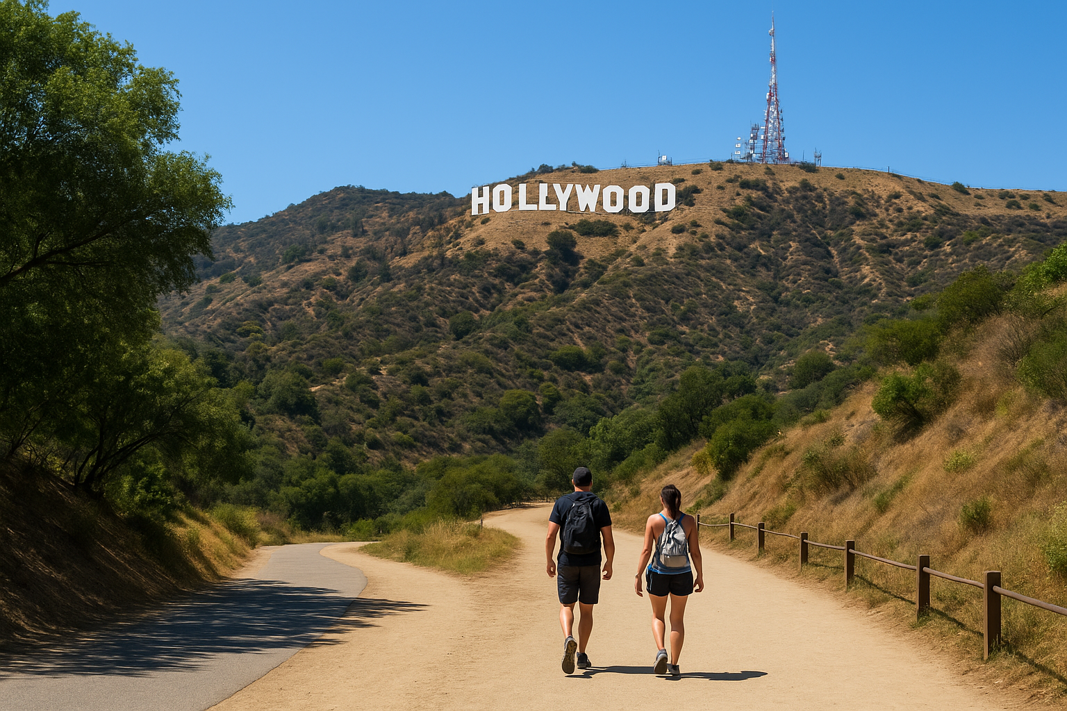
Lake Hollywood Park sits at the end of Wonder View Drive in the Hollywood Hills, and it’s the closest legal parking area to the sign itself. This is the route most first-time visitors end up on, mainly because it’s the one Google Maps recommends by default, and it’s also the start of our guided Lake Hollywood Reservoir hike to the sign. Parking fills up fast on weekends, sometimes by 9 a.m., so arrive early or plan to circle the neighborhood for a spot. From the park, you’ll walk up Wonder View Drive briefly before picking up the paved fire road that leads toward Mount Lee, the peak the sign sits on.
Distance and elevation gain
The round trip from Lake Hollywood Park to the best viewing point below the sign runs about 3.2 miles, with roughly 500 feet of elevation gain. The path itself is a paved service road for most of the way, which makes footing predictable even if the grade gets steady near the top. You won’t get a close-up of the letters from this trail; the fenced-off area keeps hikers at a respectful distance, but the iconic photo op here is arguably the best of any route because you’re looking up at the sign with the city sprawled below, and it ranks among the must-see camera stops around the city.
Estimated hiking time
Most hikers finish this loop in 90 minutes to 2 hours, moving at a relaxed pace with stops for photos. Faster hikers in decent shape can knock it out closer to 75 minutes round trip. Add extra time if you’re hiking midday in summer, since there’s minimal shade along the paved sections and the heat radiating off the asphalt slows people down more than the actual grade does.
The Lake Hollywood Park route gives you the classic Hollywood Sign photo with the least guesswork about where to park or which fork to take.
Difficulty and who it’s for
Rated moderate, this trail suits casual hikers, families with older kids, and anyone who wants a straightforward answer to how long is the Hollywood sign hike without studying a trail map beforehand. The paved surface means strollers can handle the lower section, though the incline gets tough for young kids past the halfway point. It’s not the trail for you if you want to stand directly beneath the letters, since fencing blocks that access from every legal route. For a no-fuss outing with dependable footing and a guaranteed photo, this is the one we send most visitors to first.
| Detail | Lake Hollywood Park Route |
|---|---|
| Round trip distance | 3.2 miles |
| Elevation gain | ~500 feet |
| Typical time | 1.5–2 hours |
| Surface | Paved fire road |
| Best for | Families, first-timers, photo seekers |
2. Canyon Drive via Brush Canyon Trail
Trailhead and starting point
Canyon Drive dead-ends into a small gravel lot in the Hollywood Hills, and that’s where the Brush Canyon Trail begins. Locals sometimes call it the Canyon Drive Trail, and it’s the same fire road that runs past the old Bat Cave filming location before climbing toward Cahuenga Peak. Parking here is limited to roughly a dozen spots, so weekday mornings are your best shot at grabbing one without a long walk from a side street.
Distance and elevation gain
This route runs longer than most people expect. The round trip to the back side of the sign and up to Cahuenga Peak covers about 6.4 miles, with elevation gain topping 1,000 feet. Hikers who just want the view from behind the letters, without pushing to the peak, can turn around near the 3-mile mark and cut that total roughly in half.
Brush Canyon Trail rewards hikers willing to trade extra mileage for quieter trails and a summit view most sign-seekers never reach.
Estimated hiking time
Expect 3 to 3.5 hours for the full route to Cahuenga Peak and back at a moderate pace. Shortening the hike to just the sign overlook drops the time to around 90 minutes. Either way, pack more water than you think you’ll need since shade is scarce once you clear the canyon floor.
Difficulty and who it’s for
Rated strenuous for the full peak route, moderate if you stop early. Seasoned hikers, trail runners, and anyone chasing a workout alongside their sightseeing will appreciate the climb and the thinner crowds compared to Lake Hollywood Park. It’s not the right pick for young kids or anyone hoping for a quick, low-effort answer to how long is the Hollywood sign hike, since this one demands real time and real fitness.
3. Innsdale Trail to the Hollywood Sign
Trailhead and starting point
Innsdale Drive sits in the Beachwood Canyon neighborhood, just a few blocks from the more famous Hollyridge trailhead that most guides mention. Locals use this route to dodge the crowds that clog Beachwood Drive on weekends, one of many quieter corners of Los Angeles, since street parking here is quieter and rarely fills before mid-morning. You’ll walk a short stretch of residential road before the pavement gives way to a dirt path that merges with the main trail network heading toward the sign. There’s no official trailhead marker, so a downloaded map or GPS app helps on your first visit.
Distance and elevation gain
Once you join the main path, the round trip to the fenced viewing area below the sign runs about 3.4 miles, with roughly 650 feet of elevation gain. Most of the climb happens in the first mile, where the trail switches from residential sidewalk to a narrower dirt track cut into the hillside.
Innsdale trades a little extra legwork on quiet streets for noticeably fewer hikers once you reach the dirt trail.
Estimated hiking time
Plan on 1.5 to 2 hours for the full round trip at a comfortable pace. Runners and regular hikers who know the shortcuts through Beachwood Canyon can finish faster, closer to an hour, but first-timers should budget the full window since the unmarked junctions cause more wrong turns here than on the main trails.
Difficulty and who it’s for
Rated moderate, this route suits hikers who’ve already done the popular trails once and want a quieter repeat visit. Dog owners appreciate the wider dirt sections lower down, though the trail narrows near the top. Skip this one on your first attempt if you’re relying entirely on trail signage, since the lack of official markers makes it easy to backtrack unnecessarily.
4. Wisdom Tree and Cahuenga Peak Trail
Trailhead and starting point
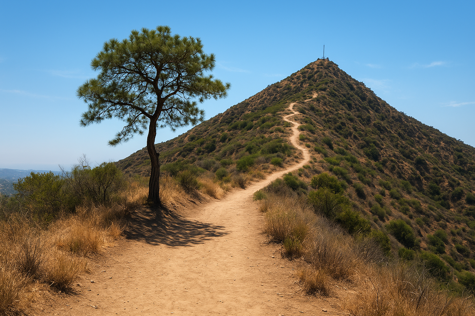
This trail starts from the same Canyon Drive lot as Brush Canyon Trail, but instead of angling toward the sign’s backside, you’ll fork left toward Cahuenga Peak, the tallest point in Griffith Park. Hikers often confuse this route with the Bat Cave path since they share the first half mile, so keep an eye out for the split near the old water tank. The Wisdom Tree, a lone pine that survived a 1950s wildfire, marks the halfway point and gives you a shaded spot to rest before the final push.
Distance and elevation gain
Round trip to the peak and back runs about 4.6 miles, with elevation gain near 1,200 feet packed into the second half. The climb steepens noticeably after the Wisdom Tree, switching from a graded fire road to a narrower dirt path with loose rock underfoot.
Cahuenga Peak trades a quick sign photo for genuine summit views over the entire San Fernando Valley.
Estimated hiking time
Budget 2.5 to 3 hours for the full loop at a steady pace, longer if you linger at the summit for the panoramic views. Anyone still wondering how long is the Hollywood sign hike on this particular route should plan around the elevation, not the mileage, since the steep final stretch slows most hikers down more than the distance suggests.
Difficulty and who it’s for
Rated strenuous, this trail suits fit hikers comfortable with loose footing and sustained climbing. It’s a poor match for young kids, casual walkers, or anyone hoping for a fast sign selfie, since the peak sits well beyond the fenced viewing areas other routes reach faster.
5. Griffith Observatory to the Hollywood Sign
Trailhead and starting point
Griffith Observatory has its own parking lot at the top of Vermont Canyon Road, and that convenience is exactly why this route appeals to visitors already planning a stop for the planetarium show times and tickets or the famous overlook. From the observatory’s east side, you’ll pick up the Charlie Turner Trail, one of several trails that start at Griffith Observatory, which connects into the same ridge system that eventually links to Mount Lee. Weekend parking fills quickly, especially around sunset when photographers show up for the skyline shot, so arriving before 10 a.m. saves you a walk up from the overflow lot on Western Canyon Road.
Distance and elevation gain
Getting from the observatory to the fenced viewpoint below the sign and back covers roughly 6 miles round trip, with elevation gain around 1,100 feet spread across rolling hills rather than one steep push. The trail dips and climbs several times along the ridge, so the total gain adds up even though no single section feels brutal.
This route answers how long is the Hollywood sign hike takes when you want scenery variety, not the fastest path to a photo.
Estimated hiking time
Budget 3 to 3.5 hours for the full out-and-back at a moderate pace, more if you pause at the overlooks along Mount Hollywood Drive. Fast hikers can trim that to around 2.5 hours, but the rolling terrain rarely lets anyone rush the whole way.
Difficulty and who it’s for
Rated moderate to strenuous given the distance, this trail suits hikers who want to combine the Hollywood Sign with Griffith Observatory on a longer walk rather than a quick sign errand. Families with young kids should skip the full route and stick to the observatory grounds instead, since the mileage adds up fast for smaller legs.
6. Bronson Canyon and the Batcave route
Trailhead and starting point
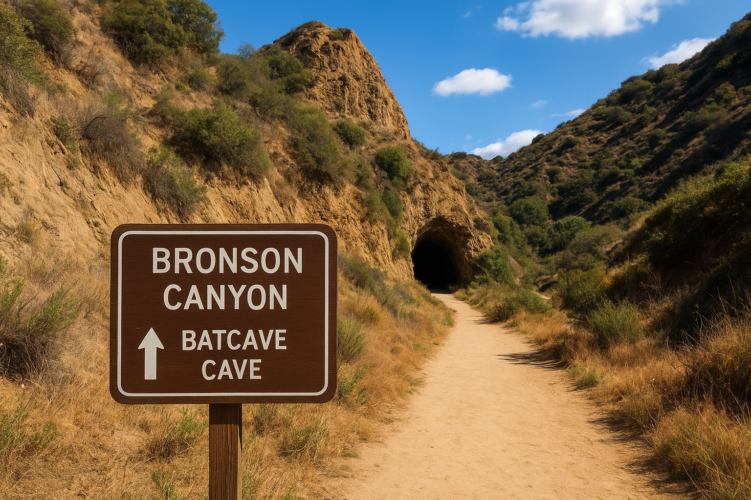
Bronson Canyon sits inside Griffith Park just off Canyon Drive, a short walk from the small parking lot that serves the Bronson Caves, the tunnel made famous as the Batcave entrance in the 1960s Batman series. Movie buffs and casual sightseers who follow film location tours around Los Angeles flock here first, then some continue on toward the sign once they realize the trail network connects. Fewer than 20 spots exist in the lot, and rangers close the gate once it fills, so early mornings or weekdays give you the best shot at parking without a long walk in.
Distance and elevation gain
Visiting just the caves is a quick out-and-back of about 1 mile with barely any elevation gain, flat enough for flip-flops. Continuing past the caves onto the connector trail that links up with the Cahuenga Peak and Brush Canyon network stretches the round trip to roughly 5 miles, with elevation gain near 900 feet once you factor in the climb toward the ridge.
Bronson Canyon works as two hikes in one: a five-minute movie-set stroll or a full afternoon climb, depending on how far past the caves you go.
Estimated hiking time
Seeing the caves alone takes 30 to 45 minutes, tunnel photos included. Pushing on to connect with the sign-view trails adds another 2 to 2.5 hours, bringing the full outing closer to 3 hours for hikers still working out how long is the Hollywood sign hike from this particular starting point.
Difficulty and who it’s for
Rated easy for the caves, strenuous if you continue toward the sign, this trailhead suits movie fans, families with small kids sticking to the tunnel, and fitter hikers looking for a less crowded approach to the peak trails. Skip the extended route with strollers or toddlers, since the connector trail narrows and climbs well beyond stroller-friendly terrain.
7. Griffith Park full loop via Mulholland Trail
Trailhead and starting point
Mulholland Trail threads through the heart of Griffith Park, one of many hiking routes inside Griffith Park, and most hikers pick it up from the Fern Dell entrance off Fern Dell Drive or the parking area near the Griffith Park Merry-Go-Round. This route strings together several connector paths, so you’ll pass junctions for Mount Hollywood, the observatory, and the Bat Cave network before circling back. Rangers post trail maps at the main junctions, but downloading an offline map beforehand saves you from backtracking on this one, since it’s the most maze-like of all seven routes.
Distance and elevation gain
Depending on which loop variation you choose, the full circuit covers 6.5 to 7.5 miles, with elevation gain between 1,300 and 1,500 feet spread across multiple ridgelines. Unlike the point-to-point trails, this loop touches the sign viewpoint, Cahuenga Peak, and Mount Hollywood in a single outing, which explains the higher totals.
The Mulholland loop turns a single sign photo into a full-park tour, at the cost of several extra hours on your feet.
Estimated hiking time
Budget a full 4 hours for this loop at a comfortable pace, closer to 3 hours if you’re an experienced hiker skipping most photo stops. Anyone weighing how long is the Hollywood sign hike against a full day of sightseeing should treat this route as a half-day commitment rather than a quick errand.
Difficulty and who it’s for
Rated strenuous, this loop suits experienced hikers chasing variety over efficiency, plus trail runners training on real elevation. Skip it if you only want the sign photo, since shorter routes get you there in a fraction of the time and effort this loop demands.
8. Which Hollywood Sign trail should you choose
Seven trails means seven different answers to how long is the Hollywood sign hike, so the right pick depends on what you’re actually optimizing for: time, photo quality, or a workout. If you only have an hour and want the classic shot, Lake Hollywood Park wins every time. If you’re chasing solitude and don’t mind extra mileage, Brush Canyon or Innsdale beat the crowded main routes without adding much difficulty.
Groups traveling with kids or grandparents should stick to paved or graded fire roads rather than the peak trails, where loose rock and steep drops turn a fun outing into a slog. Fitness level matters more than trail popularity here; a strenuous route at sunset in July humbles plenty of hikers who assumed "a walk to a sign" couldn’t be that hard.
Match the trail to your fitness and time budget first, then worry about which one has the best photo.
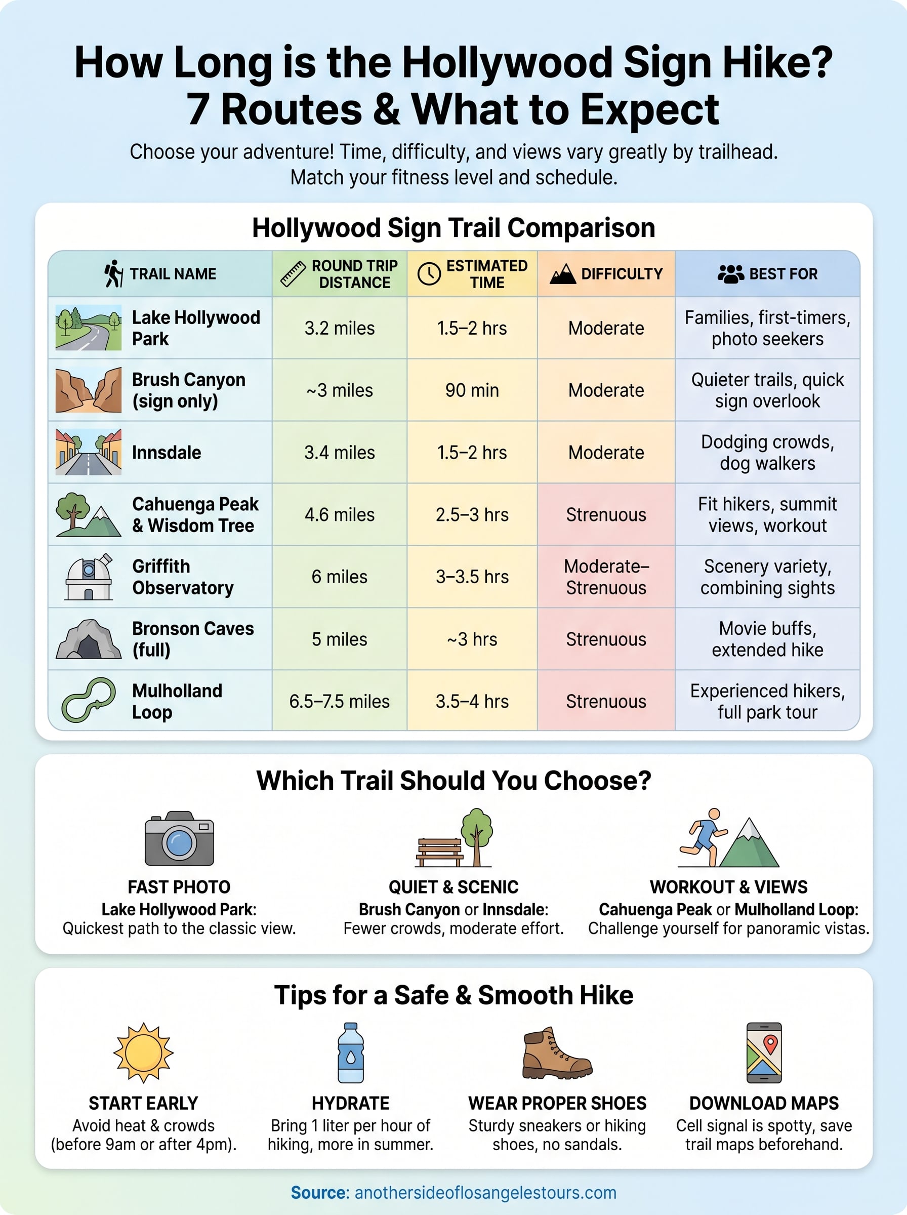
Here’s a quick side-by-side to settle the debate fast:
| Trail | Round Trip | Time | Difficulty |
|---|---|---|---|
| Lake Hollywood Park | 3.2 mi | 1.5–2 hrs | Moderate |
| Brush Canyon (sign only) | ~3 mi | 90 min | Moderate |
| Innsdale | 3.4 mi | 1.5–2 hrs | Moderate |
| Cahuenga Peak | 4.6 mi | 2.5–3 hrs | Strenuous |
| Griffith Observatory | 6 mi | 3–3.5 hrs | Moderate–Strenuous |
| Bronson Caves (full) | 5 mi | ~3 hrs | Strenuous |
| Mulholland Loop | 6.5–7.5 mi | 3.5–4 hrs | Strenuous |
Visitors short on time or new to hiking in Los Angeles should default to Lake Hollywood Park or Innsdale. Anyone training for a bigger climb, or simply bored of the same photo everyone else takes, gets more out of Cahuenga Peak or the full Mulholland loop. Weather also shifts the calculus: summer afternoons push everyone toward the shorter, shadier options regardless of fitness.
9. Tips for a safe and smooth Hollywood Sign hike
Timing beats trail choice for most hikers heading up to the sign. Start before 9 a.m. or after 4 p.m. in summer, since the exposed fire roads turn into ovens by noon and there’s almost no shade on the popular routes. Weekday mornings also solve the parking headache that ruins more hikes than any hill ever does, and the same advice on timing your LA trip applies citywide; Lake Hollywood Park and the Canyon Drive lots both fill solid on weekend afternoons.
A cooler start time fixes more problems than picking a different trail ever will.
Pack smart and you’ll skip the two mistakes we see most often: underestimating water and overestimating cell signal.
- Bring at least one liter of water per hour of hiking, more in summer
- Wear real hiking shoes or sturdy sneakers, not sandals or worn-out flats
- Download an offline trail map before you leave your hotel
- Carry a phone charger or battery pack for photos and navigation
- Check the park’s posted hours, since Griffith Park closes at sunset
Wildlife shows up more than most visitors expect. Rattlesnakes sun themselves on the fire roads in spring and fall, so stay on the marked path and keep dogs leashed. Coyotes are common at dawn and dusk but rarely bother hikers who keep their distance and don’t leave food out. If you’re hiking with kids, stick to the graded routes like Lake Hollywood Park or the observatory trail rather than anything labeled strenuous, since loose rock on the steeper paths trips up adults too.
Regardless of which trailhead you land on, the answer to how long is the Hollywood sign hike changes fastest with heat and crowds, not distance. Plan around both and the hike itself takes care of the rest.
Ready to hit the trail
Now you know how long is the Hollywood sign hike really takes, and it’s clear the answer depends entirely on which trailhead you choose. Pick Lake Hollywood Park for a fast, reliable photo, or commit to Cahuenga Peak and the Mulholland loop if you want a real workout and quieter views. Either way, start early, bring water, and match the trail to your group’s fitness rather than whatever route trends on social media that week.
Guessing at trailheads and parking still eats up more vacation time than the hike itself. If you’d rather skip the logistics and let someone who knows every fork in these trails handle the planning, our guides build that local knowledge into every outing across Hollywood and the surrounding hills. When you’re ready for a smoother version of this hike, plus the stories behind the landmarks you’ll pass, reserve a private guided tour of LA and let us handle the route.