
Griffith Park sprawls across more than 4,300 acres, and if you type griffith observatory hiking trails into Google, you’ll get a jumble of routes with no clear sense of which one actually gets you a good workout, a great view, or both. Some trails dump you in a parking lot with zero shade. Others climb straight up a fire road with no payoff until the very top. You don’t want to guess wrong on a trip where you’ve only got a few hours to spare.
This guide cuts through that confusion. We’ve picked the five best routes around the observatory, with real distances, elevation gain, and difficulty levels so you know exactly what you’re signing up for before you lace up your shoes. Whether you want a quick 20-minute walk up to the lawn or a longer loop past the Hollywood Sign, there’s a trail here that fits your timeline and fitness level.
We’ll also point out where to park, when the crowds thin out, and which trails give you the best photo angles of the observatory and the city skyline. If you’d rather skip the legwork and let a local guide handle the logistics, that’s an option too, but if you’re hiking on your own, this list will get you there without the wrong turns.
1. West Observatory Trail
The West Observatory Trail is the workhorse route most locals use when they want a fast, no-nonsense climb to the observatory lawn. It’s steep in spots, but short enough that you can knock it out before breakfast and still make it to work on time.
Distance and difficulty
This trail runs about 0.7 miles one way from the base to the observatory terrace, with roughly 500 feet of elevation gain packed into that short stretch. That math makes it a moderate-to-hard climb, not because the distance is long, but because the grade doesn’t let up. Expect switchbacks and a few sections steep enough that you’ll want good shoes with grip.
| Detail | Info |
|---|---|
| Distance | 0.7 mi one way |
| Elevation gain | ~500 ft |
| Difficulty | Moderate to hard |
| Est. time | 25-35 minutes up |
| Surface | Dirt path, some rock |
A short trail with a steep grade beats a long trail with a gentle one when you’re short on time.
Trailhead and parking
You’ll find the trailhead near the Charlie Turner parking area off Vermont Canyon Road, close to the Greek Theatre. Parking fills up fast on weekends, especially by 9am, so aim for an early start if you want a spot within walking distance. There’s no dedicated lot at the trailhead itself, so you’re working with street parking along Vermont Canyon and the nearby lots.
What you’ll see along the way
The path climbs through low scrub and chaparral with increasingly wide views of the Los Angeles basin opening up behind you. Around the halfway mark, you’ll get your first clean look at the observatory domes above, and near the top, the trail delivers a solid angle for photos of the building against the skyline before you even reach the lawn.
Good to know before you go
There’s no shade on this trail, so skip the midday sun in summer if you can. Bring water even for a short hike like this one, since the grade will get your heart rate up fast.
2. East Observatory Trail
The East Observatory Trail mirrors its western counterpart but draws a smaller crowd, which makes it the better pick if you want a quieter climb without sacrificing the payoff at the top. It’s a solid alternative when the West Observatory Trail parking lot is jammed.
Distance and difficulty
Expect about 0.6 miles one way with around 400 feet of elevation gain, putting it just under the West Trail in both length and climb. The grade is steady rather than punishing, so it suits hikers who want a workout without the steepest switchbacks.
| Detail | Info |
|---|---|
| Distance | 0.6 mi one way |
| Elevation gain | ~400 ft |
| Difficulty | Moderate |
| Est. time | 20-30 minutes up |
Fewer hikers on the trail usually means a calmer climb and a better shot at an unobstructed photo up top.
Trailhead and parking
Start from the small lot off Fern Dell Drive near the eastern edge of the park. Spaces here fill up slower than at Charlie Turner, so it’s a good backup when the main lot overflows.
What you’ll see along the way
The route winds through denser tree cover than the West Trail before opening onto rocky terrain with views toward the Hollywood Sign.
Good to know before you go
Bring sturdy shoes. Sections near the top get loose gravel, and the trail narrows in a few spots where passing hikers need to squeeze by.
3. Fern Dell Nature Trail
The Fern Dell Nature Trail is the easiest of the bunch, and it’s the one to pick if you’re traveling with kids, grandparents, or anyone who wants shade over a workout. It’s less a climb and more a stroll through a canyon full of ferns and old growth trees, tucked below the main griffith observatory hiking trails network.

Distance and difficulty
This loop covers about 0.4 miles with barely 100 feet of elevation gain, making it the flattest option on this list. Anyone can handle it in sneakers, and there’s no real climb to speak of until you connect to a steeper trail beyond the dell.
If your group has mixed fitness levels, start here before deciding whether to push on to the observatory.
Trailhead and parking
Park along Fern Dell Drive, where a small lot and street spots sit right at the canyon entrance. It’s usually less crowded than the Charlie Turner lot, even on weekends.
What you’ll see along the way
Expect a shaded canopy overhead, a small stream running alongside the path, and dense fern beds that feel far removed from the city just blocks away.
Good to know before you go
This trail alone won’t get you to the observatory. Treat it as a warm-up walk, then connect to East or West Observatory Trail for the climb up.
4. Mount Hollywood Trail
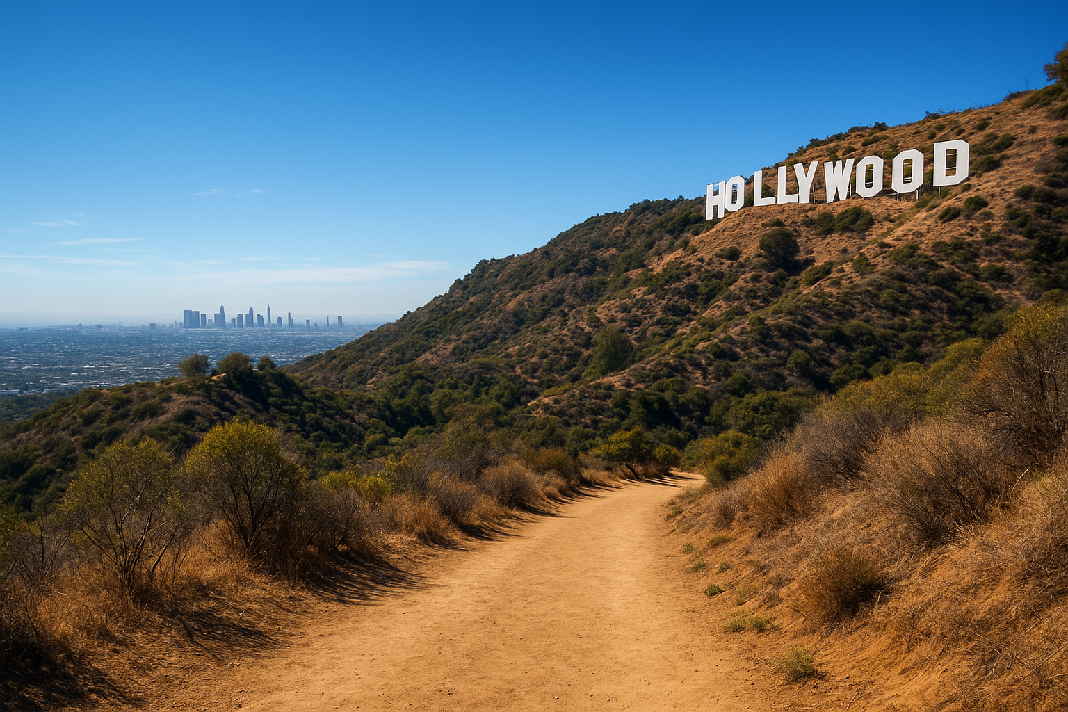
The Mount Hollywood Trail is the one to pick if you want real mileage and a summit view that beats the observatory lawn itself. It climbs past the observatory to the actual peak of Mount Hollywood, so you get the building, the Hollywood Sign, and the downtown skyline all in one sweep.
Distance and difficulty
Plan on 3 miles round trip from the Charlie Turner parking area to the summit and back, with about 500 feet of elevation gain spread across a gentler grade than the West Observatory Trail. That makes it moderate rather than brutal, though the distance means you’ll want more than sneakers and a water bottle.
More distance with a gentler grade beats a short trail that punishes your knees.
Trailhead and parking
Start at the same Charlie Turner lot off Vermont Canyon Road, then follow signs toward Mount Hollywood rather than cutting straight up to the observatory terrace.
What you’ll see along the way
You’ll pass through open chaparral with wide-angle views stretching from the Pacific to downtown LA, plus a clear shot of the Hollywood Sign from the ridge near the top.
Good to know before you go
There’s minimal shade past the first quarter mile, and the summit gets windy even on calm days, so pack a light layer.
5. Charlie Turner Trail and Berlin Forest loop
The Charlie Turner Trail and Berlin Forest loop combines a straightforward climb with a shaded detour through one of the park’s lesser-known corners. It’s the pick for hikers who’ve already done the observatory climb once and want a route that feels different without adding much distance.
Distance and difficulty
This loop runs about 2 miles total, with roughly 450 feet of elevation gain split between the climb up and the wooded stretch through Berlin Forest. Call it moderate. The Berlin Forest section is nearly flat, so the effort front-loads early in the hike.
A loop that mixes climb and shade beats an out-and-back when you want variety in one hike.
Trailhead and parking
Start at the Charlie Turner parking area off Vermont Canyon Road, the same lot used for the West Observatory and Mount Hollywood trails. Get there early, since this lot serves three of the five trails on this list.
What you’ll see along the way
After the initial climb, the trail drops into Berlin Forest, a grove of pines and cedars planted decades ago that feels nothing like the surrounding chaparral. It’s one of the few genuinely shaded stretches in this part of the park.
Good to know before you go
Signage in Berlin Forest is sparse, so download an offline map before you go. Cell service gets patchy once you’re under the tree cover.
Picking the right trail for your visit
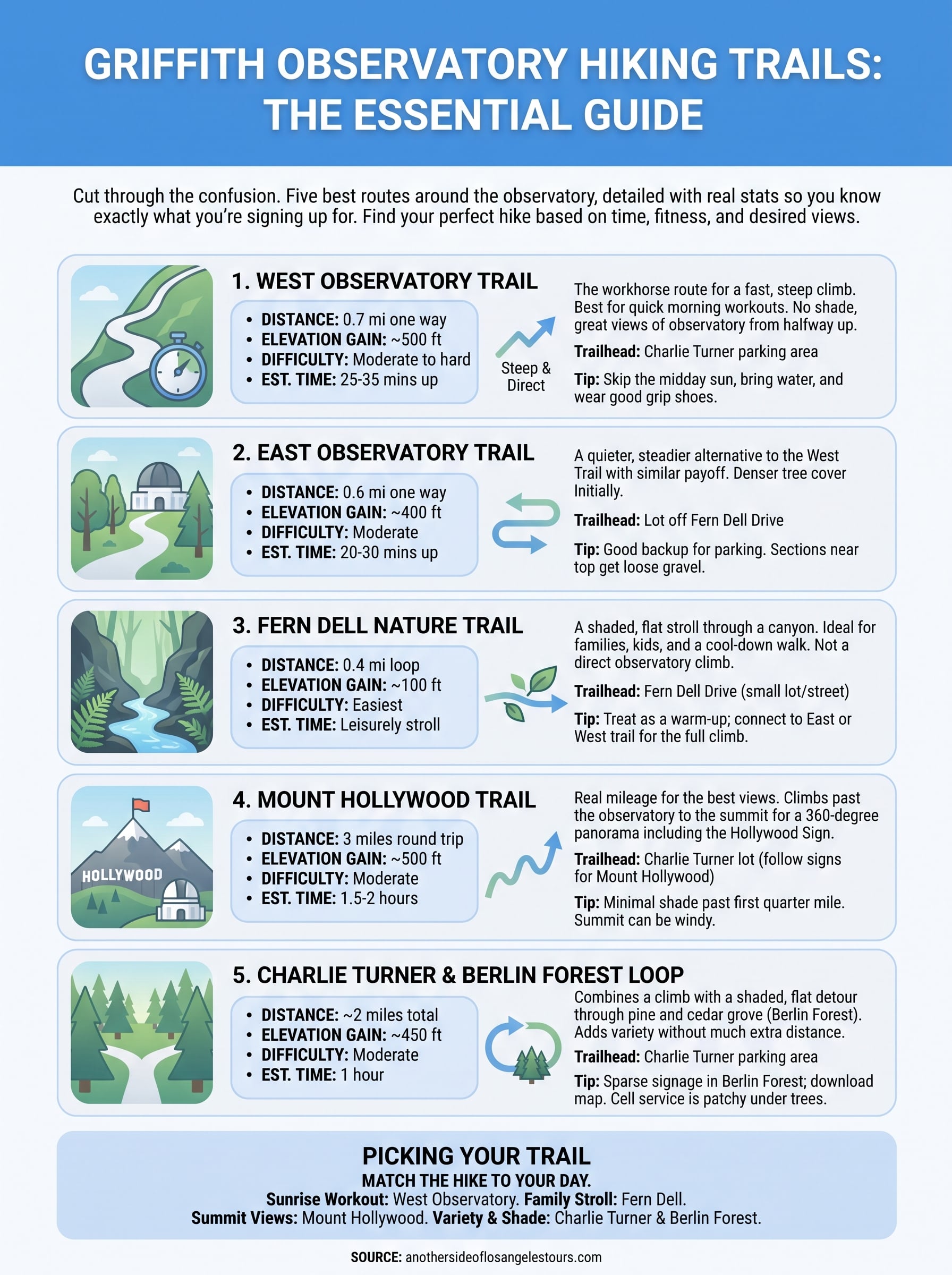
Match the trail to your day, not the other way around. Grab a quick sunrise workout on the West Observatory Trail, bring the family down the flat, shaded Fern Dell Nature Trail, or block out a couple hours for the Mount Hollywood Trail if you want the summit view over the lawn view. Any of these five routes will get you to the observatory without the wrong turns or the wasted parking loops.
Sometimes you’d rather skip the map-checking altogether and just enjoy the views. If that sounds like your trip, a guided option covers the history, the best photo spots, and the parking headaches for you. Check out Los Angeles daily sightseeing tours that include Griffith Observatory and let a local guide handle the logistics while you take in the skyline.